Living Streets Case Study

Learn about the growing momentum for people-friendly streets, read about our concept for living streets and some of the challenges to implementing them, and get the details on our demonstration projects along with our unique approach to community participation.

View the Case Study on Issuu or click here to download a PDF version.lsla_cover_web

A New Movement for The New City: Reallocating Space Away from the Car

This article succinctly explains much of the essence of what Living Streets LA is about, so it seemed worth redistributing per the attribution policy of This Big City.

bikecity

By  on March 15, 2013 at This Big City

This post is also available in: Chinese (Traditional)French

This is the second of two posts [on this Big City] based on Bruce McVean’s The New City lecture given on Monday 11thFebruary 2013 at Cambridge University Department of Architecture. You can read Part 1 here.

Cities need to redefine their relationship with the car – shaping cars and driver behaviour to suit cities, not cities to suit cars. This doesn’t mean banning cars outright, but rather reminding people that when they drive into the city they and their car enter it as guests.

Research by Sustrans and Social Data in 2004 estimated that a car is essential for approximately a third of journeys, such as those that involve moving heavy and bulky loads. The convenience and flexibility that the car can provide means it will always be around in one form or another.

We must, however, begin to address some of the inherent inefficiencies built into a car dominated transport system. Cars take up a lot of space and most of the time they’re occupying that space without even moving. They’re also expensive to own – even before you put any petrol in the tank you have to buy a car and pay Vehicle Excise Duty and insurance.

If a car is only essential for a third of your journeys, why would you need or want to own one? Wouldn’t it be better to use a shared car and in the process have access to a range of vehicles suited to the job in hand? Of course it would, and it’s no surprise that car clubs and pay-as-you-drive schemes are a growth industry.

If the private car’s time is up, the age of the bicycle is just beginning. Bikes, the ultimate form of private urban transport, are space efficient, genuinely zero emissions, healthy, sociable, affordable and fun.

If cities are to realise the potential of the bike as a form of mass transit then they must be welcoming to cyclists of all ages and abilities. Creating the conditions for mass cycling demands reducing traffic speeds and volumes on all streets and building segregated cycle lanes where traffic speeds and/or volumes remain high enough to require them.

Road space in cities is a precious commodity and a highly contested one too, but capacity must to be found to allow the reallocation of road space to bikes and public transport.

Congestion charging in London and elsewhere has been proven to be very effective at reducing traffic volumes. Spare road capacity can then be reallocated to create improved conditions for pedestrians and cyclists and improve the reliability of public transport.

Exhibition-Rd

Exhibition Road in London, which was recently converted to shared space

The reallocation of space away from the car will help restore city streets to their proper function as places for people and activity as well as traffic. Streets are complex places, where the conflicting demands of many users must be balanced. On many streets the balance is currently tipped in favour of keeping motor vehicles moving at the expense of other users.

Temporary street closures of all varieties, from the wonderful Playing Out Project in Bristol to Bogota’s much imitated Ciclovia, have an important role to play in helping people imagine a different future; one where the balance is tipped in the other direction, putting the needs of residents, shoppers and workers above the needs of the passing motorist.

Temporary closures can become permanent over time. Each summer for the last ten years Paris has closed a section of the expressway on the banks of the Seine so that it can be turned into an urban beach, the Paris Plage. 2.5km of that expressway is now set to be permanently converted into a pedestrian boulevard.

New York, meanwhile, has been piloting much quicker conversions. Paint, planters and bollards are used to mark out new public spaces and trial potentially controversial schemes that may otherwise never get off the drawing board – sometimes it’s better to seek forgiveness than ask permission.

All of the above ideas and initiatives (and the rest that there hasn’t been space to mention), must be brought together in an integrated sustainable transport strategy. Too often transport policy leaps from project to project, many of them capital intensive big infrastructure projects, without being informed by a coherent vision of how a city’s transport system should serve the city into the future.

Cities must look backwards as well as forwards when setting that vision. It’s easy to fall under the spell of new technology or twiddle our thumbs while we wait for a technological silver bullet like self-driving cars to solve our problems, but much of what is required to establish a sustainable urban transport system and move cities away from car dependency has been around for a long time.

Since the 60s and 70s many cities have been redefining their relationship with the car – particularly in the Netherlands and elsewhere in northern Europe. So a ‘new movement’ has already started, but given the urgent need to address the social, economic and environmental impacts of car dependency it needs to quickly gather momentum. Copenhagen has been in the process of transforming itself for 50 years, it still has some way to go and other cities that are just beginning the process don’t have the luxury of time.

Cities must move as quickly as possible towards achieving the ultimate goal – a liveable city served by a resilient transport network. A network that will help the city respond to the challenges of climate change and peak cheap oil while improving quality of life and reducing inequalities. To paraphrase that great observer of city life William H Whyte, urban transport systems must help cities assert themselves as good places to live.

Bruce McVean is Integrated Design Manager at Beyond Green and Founder of Movement for Liveable London

Top image via jpctalbot

This article originally appeared on the sustainable cities website This Big City.

Northeast LA Takes Back Its Streets

How-to-Guidebooks for Community-Driven Street Improvements

By Larry Kaplan

A steady, dramatic shift is happening in the way Americans think about urban life, moving toward streets that are centered around people. In Southern California, we’d expect to see this in communities known for their cutting edge approach to urban design, like Santa Monica and West Hollywood.

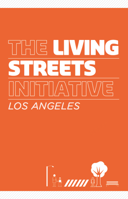
But on the East Side? Yes, there too. We’re talking about two projects by the Green LA Coalition’s Living Streets Initiative—on York Boulevard in Highland Park and Huntington Drive in El Sereno.

Green LA’s Ryan Lehman, who chairs the initiative, partnered with Steve Rasmussen Cancian of Shared Spaces Landscape Architecture, to bring together community stakeholders and create a vision for improving the burgeoning stretches of street—and at the same time, realize immediate visible changes. This was the vision of LA Councilmember José Huizar, who represents the area.

The York Blvd. Action Plan is a guide for realizing the Highland Park community’s vision for an improved York Blvd. In 2011, over 200 local residents, business people and organizational leaders worked together in over 15 workshops to develop a shared vision for improving it.

Not far away, the Huntington Dr. Action Plan realizes the El Sereno community’s vision for improving their own “downtown”- along Huntington from Maycrest Ave. to Collis Ave. Also in 2011, over 150 local residents, business people and organizational leaders worked together in 10 workshops to develop a shared vision for improving this important stretch of street.

So what is an Action Plan? Action Planning focuses on immediate and medium term improvements that can be implemented relatively quickly, inexpensively and incrementally. While traditional master plans develop an ideal vision of a place-and then draw that vision as a guide to future projects that may never happen, action planners ask, “If we have X dollars to spend this year, which improvements should we make? And then, once those are done, what comes next?”

Once the community answers these questions, action planners actually implement the neighborhoods’ top choices, primarily low-cost improvements that can be designed and built relatively quickly, using these immediate projects to build momentum. Then the planners create a guide with step-by-step work plans and tools, so that community members can implement the balance of their priorities as resources become available. Between the two plans, the Living Streets team distilled the many ideas brainstormed and discussed by community members into do-able actions that will incrementally improve two key area streets.

“Streets are not there only to balance the needs of walkers, bicyclists, transit riders and drivers. Environmental restoration, economic equity and community engagement are essential to revitalizing neglected neighborhoods, so transforming streets in the City’s urban core into vibrant, inviting and green community spaces is a great way to show that this approach works,” says Ryan.

The York Blvd. Vision Project exemplified this Action Planning process. “When I saw the meeting announcements, I had just opened my business,” says Cathi Milligan, who owns the Glass Studio, an art gallery on York, “I wanted to be a part of the process, which was amazing—it was a successful way of getting community feedback. It allowed the community to be educated about the options and make intelligent decisions, and people were excited.”

Through this planning process, the community created a truly shared vision, and developed a strategic list of cost effective, incremental improvements that together would realize their vision.

Now, three immediate projects are already being realized by the York Blvd. community:

-Creating a Street Porch on York between Avenues 50 and 51.
-Creating a park on the southwest corner of York and Ave. 50
-Installing a demonstration phase of pedestrian street lights with an historic character.

The York Porch will be built in the fall of 2012 as one of four Council District 14 demonstration projects that will set the standards for street porches—and all types of parklets and mini-plazas—across Los Angeles. The community’s vote to prioritize applying for funding to create a park resulted in a $2.85 million state grant to purchase the lot on the southwest corner of York Blvd. and Ave. 50 and develop it as a hybrid neighborhood park and Main St. Plaza that weaves together the boulevard and the surrounding residential neighborhoods.

“Through this step-by-step, improvement-by-improvement, process, the people of Highland Park are already realizing their vision of an improved York Blvd.,” says Councilmember Huizar, whose staff was instrumental in the process.

The Huntington Dr. Action Plan, also in the Councilmember’s district, was developed through the same community engagement and design process. Community members sought to create a town square atmosphere where people are encouraged to stop, shop and relax; to green, brighten and lighten-up El Sereno’s “downtown;” and to accentuate the creative, local, and historic character of the community.

After creating a list of improvement components, community participants voted to prioritize two of them for immediate implementation:

-A Street Plaza in the center of downtown in front of Food for Less.
-A sidewalk plaza at the northern gateway to El Sereno at Maycrest Ave.

The El Sereno St. Plaza was created by the community in multiple workshops, in which they sought to combine the neighborhood’s cultural and natural history to create an “only in El Sereno” space. The Street Plaza will be built in the fall of 2012 as one of four 14th District demonstration projects that will set the standards for street plazas across Los Angeles. And while the community’s first focus was a gathering place at the center of downtown, participants were equally clear that it was important to mark and improve El Sereno’s gateways, beginning with the commercial corner at the northern end of downtown at Maycrest Ave.

A version of this article was sent to the Green LA Coalition’s e-newsletter list.

Read the plans on Issuu below or download them here.

I Wish This Street was…Living Street Demonstration at CicLAvia

Living Streets LA presents “I Wish this Street Was…” An interactive play street which will allow participants and passersby to envision what College Street in Chinatown could be like without cars. During the Sunday, October 7th CicLAvia, College Street between Broadway and Alameda Street will be transformed into a pedestrian only street through an interactive workshop hosted by James Rojas, public art projects and imaginative games. Click here for the event’s Facebook page.

We could still use volunteers to help set-up and host the event. If interested, please contact Anna Peccianti at anna.peccianti[at]gmail.com and let her know what time you would be available between 8am-4pm. We would appreciate it if each volunteer can help out for at least two hours.

A Place in the Sun

LA’s burgeoning Silver Lake neighborhood scored big last week, gaining not only LA’s second bike corral but reclaiming a snippet of public street for the public’s use with the city’s first street-turned-pedestrian-plaza.

“Sunset Triangle” is based on the scrap of land left where Griffith Park Boulevard angles into Sunset a block or so east of Sunset Junction. Now the short bit of Griffith Park between Edgecliffe and Sunset has been closed to cars and opened to unarmored human beings (though it’s briefly interrupted by an access strip to a bakery’s parking lot).

Although the project’s announcement touts its resemblance to the also-triangular Times Square treatment in Manhattan, they are nothing at all alike: Sunset Triangle is a neighborhood space, long used as a mini-park, where a farmers market sets up twice a week–and it is not in the heart of town, nor is it a tourist district. While it would be wonderful to see a pedestrian plaza at Hollywood and Highland, in the Miracle Mile, somewhere on Ventura, or Downtown (where My Figueroa might actually make it happen), in a way this is better: Sunset Triangle is primarily for Angelenos.

Silver Lake is already a bike-enriched neighborhood, and replete with sidewalk strollers, dozens of bistros, cafés, coffeehouses, restaurants, pubs, bars, and breweries, and a dizzying selection of boutiques ranging from the ordinary to the esoteric. It’s the perfect location for a true public square where people can mingle and linger freely, sipping a cup of coffee, enjoying a sandwich, or just chatting up their neighbors, without having had to wrestle a two-ton prosthetic down the crowded lanes and into a rare parking space. You just walk in or ride your bike–as so many do already–sit down, and enjoy life.

What a concept, eh?

It’s also at the intersection of two bike lanes: the one on Griffith Park feeds in from North Silver Lake, starting just short of Hyperion and Rowena, and the Sunset Boulevard lanes connect the plaza to Downtown, Echo Park, East Hollywood, and the main part of Silver Lake.

It took the residents of Silver Lake six years to get this plaza built, so if we want more, we’d better start now!

I’m sure there are neighborhoods all over LA that would love a square of their own–or even a triangle.

A version of this article by Richard Risemberg was originally published in Flying Pigeon LA.

A Call for Volunteers from Streets for People

On March 2nd and 3rd, Streets for People will begin filling the planters at Sunset Triangle Plaza and we could use your help! If you are interested in volunteering for this project, please email Anna at streetsforpeoplela[at]gmail.com


Date —Friday, March 2nd from 10 am – 2 pm and Saturday, March 3rd from 2-6 pm. 

Location Address — Sunset Triangle Plaza (Griffith Park and Sunset Blvds), Los Angeles

Contact — Anna, streetsforpeoplela[at]gmail.com

LADOT to Start Work this Sunday, February 19th on Sunset Triangle Plaza Project

Starting this Sunday, February 19, LADOT will close the one block of Griffith Park Boulevard, between Maltman and Edgecliffe Drives, to begin work on the Sunset Triangle Plaza project, a Streets for People (S4P) initiative. LADOT will use temporary barriers to close the site as they proceed with preparations that will include street surface grinding and painting, signage amends, and installation of bike corral and a safety barrier of planters. On Sunday, March 4, the Plaza will be officially opened with a ceremony set for 11:00am. The community is invited to join the celebration from 11:00 am to 2:00 pm.

More information about the Plaza program, LADOT work and Opening Day celebrations will be posted here as it becomes available.

The pilot Plaza will temporary close Griffith Park Blvd to automobile traffic for the duration of the project (approximately one year). There will be no changes Edgecliffe Dr. (on the west side of the plaza) so that automobiles may continue to access to Sunset and Griffith Park Boulevards. At Sunset Triangle Plaza, the twice-weekly farmer’s market will continue to operate uninterrupted and parking spaces will be created along Sunset Blvd, and all street furniture will be brought inside each evening to maintain its quality and cleanliness.

Contact information:

For community members:

Ryan R. Carpio, Field Deputy
Office of Council Member Eric Garcetti
Los Angeles City Council District 13
5500 Hollywood Blvd. 4th Floor
Los Angeles, CA 90028
Office: (323) 957-4500

For press:

Julie Wong
Office of Council Member Eric Garcetti
Los Angeles City Council District 13
Office: 213-473-7013